Demo
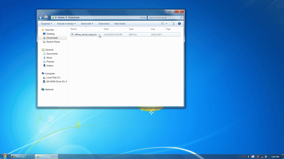
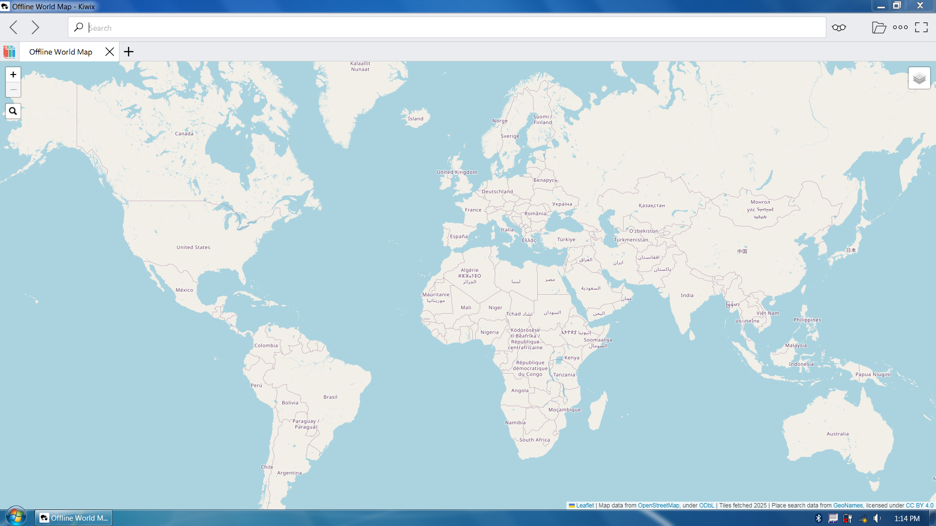
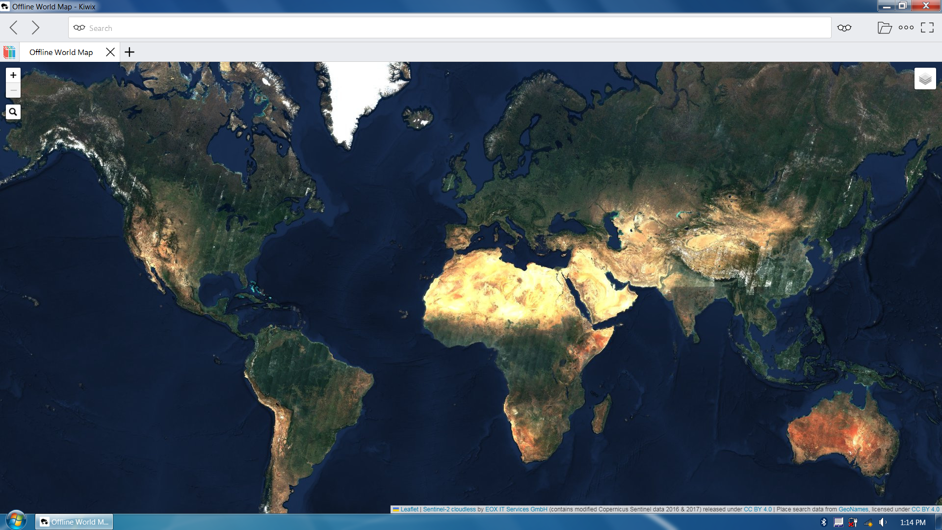
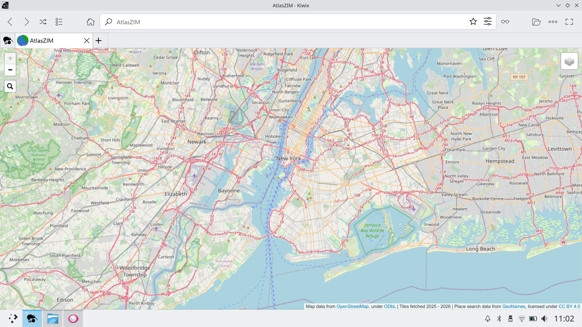
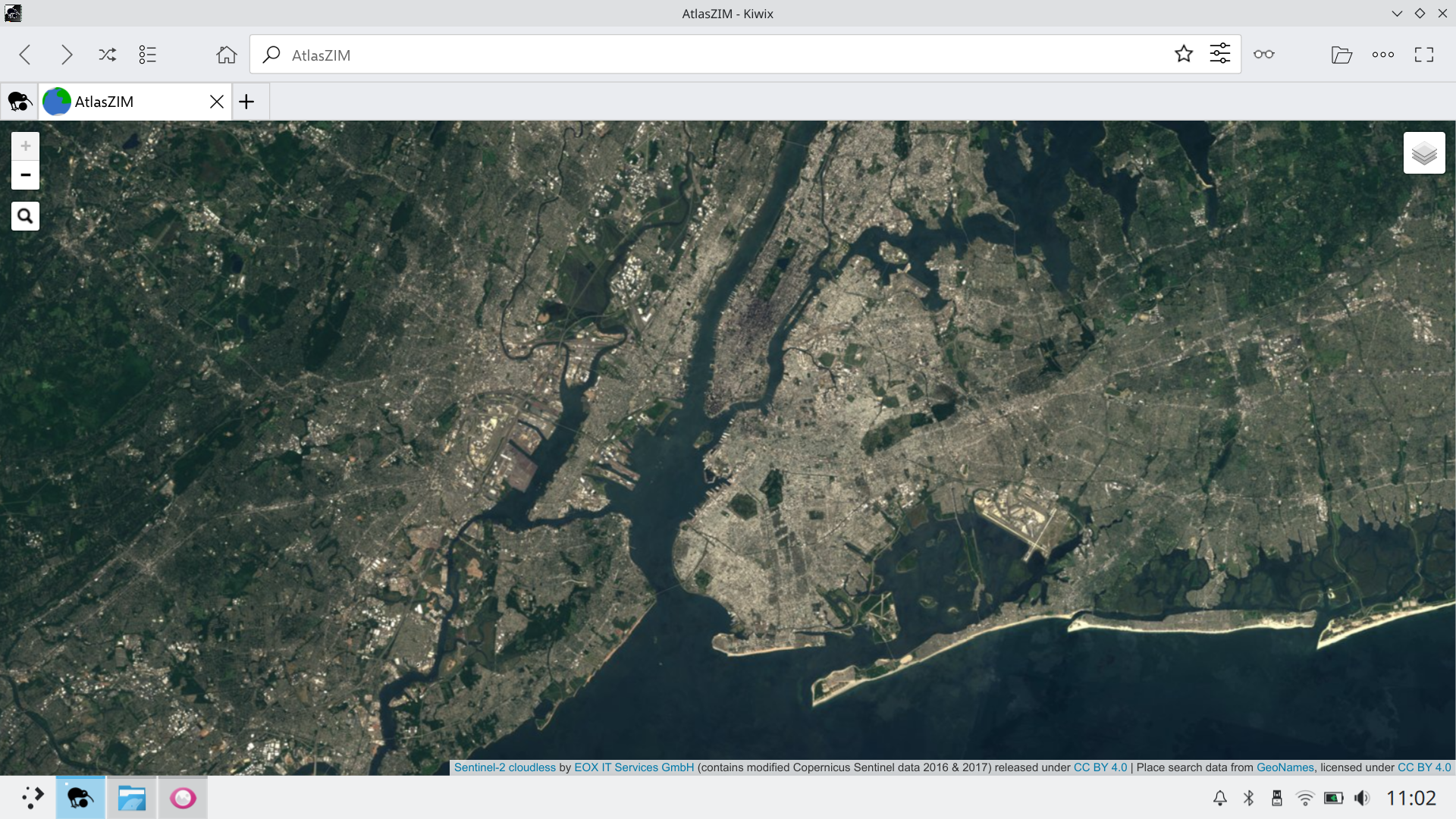
Screenshots
Customer review
Michael Stewart rated AtlasZIM 5 out of 5 stars.
“I appreciate having a .zim formatted map with associated satellite view available through Kiwix.”
Gumroad customer review excerpt — July 10, 2026
When to use this
Use AtlasZIM when you want:
- A fully offline world map / digital atlas experience (no network required at runtime)
- A single-file (
.zim) map and satellite imagery archive solution - An offline geographic reference that runs on platforms supported by Kiwix (desktop + mobile)
- Offline place-name lookup/search (GeoNames-backed)
Not intended for:
- Turn-by-turn navigation, routing, or directions
- Live traffic, real-time updates, or online map APIs
- Scenarios where you need frequently-refreshed map data (this is an offline snapshot)
What this includes
AtlasZIM is a self-contained map application bundled inside a single .zim file. When opened in
Kiwix, it behaves like an offline website.
- OpenStreetMap-based raster map tiles
- Sentinel-2 cloudless satellite imagery
- A Leaflet-based JavaScript map viewer
- An offline place search UI built with Leaflet.Control.Search and GeoNames data
FAQ
Does AtlasZIM require internet access?
No. After download and setup, AtlasZIM runs fully offline inside Kiwix. The map tiles, satellite imagery, place search data, JavaScript, CSS, images, and supporting files are bundled into the ZIM file.
Does AtlasZIM work on phones and tablets?
Yes. AtlasZIM works anywhere Kiwix supports ZIM files, including desktop and mobile platforms. The practical constraint is storage space, since recent versions of AtlasZIM are large.
Does AtlasZIM support routing or turn-by-turn navigation?
No. AtlasZIM is designed as an offline atlas and geographic reference, not as a routing or navigation application. It is useful for browsing, visual reference, and place lookup, but it does not calculate routes or provide directions.
Does AtlasZIM include search?
Yes. AtlasZIM v5 and later include offline place-name search using bundled GeoNames data. Search works without an internet connection.
Why is the file so large?
AtlasZIM includes millions of pre-rendered OpenStreetMap and satellite imagery tiles covering the world across multiple zoom levels. This makes the download large, but it also allows the atlas to run offline without requesting map tiles from an online service.
Why ZIM instead of traditional offline map formats?
Most offline maps are distributed as MBTiles, vector databases, or app-specific formats. AtlasZIM explores a different approach: using ZIM as an offline web container.
Advantages:
- Single-file distribution
- Works on all platforms supported by Kiwix (desktop and mobile)
- No dedicated map application required
Why not use vector tiles?
AtlasZIM intentionally uses pre-rendered raster tiles rather than vector tiles. Vector tiles can significantly reduce storage requirements, but they shift more work to the client device, including geometry decoding, rendering, and memory use.
Raster tiles are simple for Kiwix to serve and lightweight for the browser to display, which helps AtlasZIM behave more consistently across older and lower-power devices. Also, because a substantial portion of the dataset is satellite imagery — which is inherently raster — vector tiles would not reduce the total size as dramatically in this context. The goal is maximum compatibility and predictable performance rather than minimal disk usage.
Is the map data live or continuously updated?
No. AtlasZIM is an offline snapshot. It does not include live traffic, real-time updates, online map APIs, or continuously refreshed map data.
Inside the ZIM file
ZIM is an open file format, so AtlasZIM is not an opaque app bundle. Its internal structure can be inspected with standard ZIM tools after download.
At a high level, AtlasZIM is a self-contained offline web application: HTML, JavaScript, CSS, map tiles, satellite tiles, search index files, images, and license files are all bundled into a single .zim file.
.
├── geonames_index
│   ├── aabe.txt
│   ├── aach.txt
│   └── ...
├── icon.png
├── images
│   ├── loader.gif
│   └── search-icon.png
├── index.html
├── leaflet
│   ├── images
│   │   ├── layers-2x.png
│   │   ├── layers.png
│   │   ├── marker-icon-2x.png
│   │   ├── marker-icon.png
│   │   └── marker-shadow.png
│   ├── leaflet.css
│   ├── leaflet.js
│   ├── leaflet.js.map
│   ├── leaflet-src.esm.js
│   ├── leaflet-src.esm.js.map
│   ├── leaflet-src.js
│   └── leaflet-src.js.map
├── leaflet-search
│   ├── leaflet-search.min.css
│   └── leaflet-search.min.js
├── licenses
│   ├── atlaszim.txt
│   ├── leaflet-control-search.txt
│   └── leaflet.txt
├── map_tiles
│   ├── 0
│   │   └── 0
│   │       ├── 0.png
│   │       └── 0.txt
│   ├── 1
│   │   ├── 0
│   │   │   ├── 0.png
│   │   │   ├── 0.txt
│   │   │   ├── 1.png
│   │   │   └── 1.txt
│   │   └── 1
│   │       ├── 0.png
│   │       ├── 0.txt
│   │       ├── 1.png
│   │       └── 1.txt
│   └── ...
└── sat_tiles
    ├── 0
    │   └── 0
    │       └── 0.jpg
    ├── 1
    │   ├── 0
    │   │   ├── 0.jpg
    │   │   └── 1.jpg
    │   └── 1
    │       ├── 0.jpg
    │       └── 1.jpg
    └── ...
Note: The tree above is truncated (in 3 places) for readability.
Features
- Global coverage
- Multiple zoom levels
- Map and satellite imagery layers
- Fully offline pan-and-zoom navigation
- Offline place search
- Runs entirely inside the Kiwix reader
- Coverage extends between ±85.051129° latitude due to use of the Web Mercator projection.
Downloads
Price: $50 — one-time purchase, includes access to the current release and all prior versions.
Digital product: AtlasZIM is delivered electronically as a download. No physical item is shipped.
Requirements & Installation
File size
Depending on the version, AtlasZIM can be large. Verify sufficient free space before downloading.
Download format
For some versions of AtlasZIM, the file size exceeds Gumroad’s 16 GiB limit, so the download is provided as multiple .7z archive parts.
For these versions, after downloading all parts, use 7-Zip (free, open-source) or a compatible archive tool to extract and combine them into a single .zim file.
How to use
Open the resulting .zim file with Kiwix (available for Windows, macOS, Linux, Android, iOS, Raspberry Pi, and more). The map runs entirely offline inside the Kiwix reader.
Videos
- Desktop Demo of v6 (introduced zoom level 11): AtlasZIM (v6), Desktop
- Mobile Demo of v6 (introduced zoom level 11): AtlasZIM (v6), Mobile
Show demos of previous releases
- Desktop Demo of v5 (introduced search): AtlasZIM (v5), Desktop
- Desktop Demo of v4 (added Leaflet navigation): AtlasZIM (v4), Desktop
- Desktop Demo of v1 (initial release): AtlasZIM (v1), Desktop
Data sources, licensing, and attribution
This project is a compilation and packaging effort. Individual components are licensed separately:
- OpenStreetMap data © OpenStreetMap contributors (ODbL)
- Satellite imagery: Sentinel-2 cloudless (CC BY 4.0, EOX IT Services GmbH)
- Place search data: GeoNames (CC BY 4.0)
- Leaflet © Vladimir Agafonkin and contributors (BSD 2-Clause)
- Leaflet.Control.Search (MIT-style license)
AtlasZIM compilation, integration, and packaging © Anthony Karam. All rights reserved.
This means the packaged AtlasZIM ZIM file may be used for personal use, but may not be redistributed, resold, or included in other products without permission. Individual components remain subject to their respective licenses.
Version history
A single purchase provides access to the current release and all prior versions.
| Version | Release Date | Branding | Size | Data | Zoom | Features |
|---|---|---|---|---|---|---|
| v6 (current) | 2026-04-22 | AtlasZIM | ~35.0 GiB | Map tiles (from 2025-2026) and satellite tiles | 0–11 | Leaflet-based navigation with search functionality |
| v5 | 2026-01-21 | Offline World Map | ~18.7 GiB | Map tiles (from 2025) and satellite tiles | 0–10 | Leaflet-based navigation with search functionality |
| v4 | 2025-12-06 (with minor update 2026-01-14) | Offline World Map | ~18.7 GiB | Map tiles (from 2025) and satellite tiles | 0–10 | Leaflet-based navigation without search functionality |
| v3 | 2025-11-25 | Offline World Map | ~10.0 GiB | Map tiles (from 2025) and satellite tiles | 0–9 (equivalent to 1-10 for 256-px tiles) | Basic navigation without search functionality |
| v2 | 2025-11-25 | Offline World Map | ~2.9 GiB | Map tiles (from 2025) and satellite tiles | 0–8 (equivalent to 1-9 for 256-px tiles) | Basic navigation without search functionality |
| v1 | 2025-08 | Offline World Map | ~1.1 GiB | Map tiles (from 2025) only | 0–8 (equivalent to 1-9 for 256-px tiles) | Basic navigation without search functionality |
Contact
Questions or feedback about AtlasZIM? Email info@atlaszim.com.
Project metadata
- Project name: AtlasZIM (formerly Offline World Map)
- Product type: Digital download
- Format: ZIM file
- Platform: Kiwix (desktop and mobile)
- Category: Offline maps / geographic reference / digital atlas
- Technologies: Leaflet, OpenStreetMap, Sentinel-2, GeoNames
- Author: Anthony Karam
- Canonical URL: https://atlaszim.com
- GitHub Repo: https://github.com/anthonykaram/atlaszim
- GitHub Pages mirror: https://anthonykaram.github.io/atlaszim/